
NEWS
Scotland’s Clear-Sky Sunrises Came With a 2°C Chill
Weather Watchers caught a 2°C Scottish sunrise on 8 October, the same clear night that leaked heat, hours before rain and wind arrived.

Clear skies overnight dropped parts of eastern Scotland to 2°C on 8 October and filled Weather Watchers with sunrise photos. In Edinburgh the sun came up at 07:29. Weather presenter Joy Dunlop told Radio Scotland Breakfast there were “beautiful pictures coming in from our Weather Watchers”, then warned that the dry spell would worsen as wind and rain moved in.
The glow and the cold were the same night’s work. By afternoon the west was already losing the blue.
The Glow Came With a 2°C Start
Watcher Fleur logged the morning near Arbroath in Angus at just two degrees, then still caught the sun. That is a coastal reading, not a mountain one, and it matches what a cloudless night does to low ground in early October. Heat stored in fields, roofs and the sea wall had hours to leak away, with no cloud to hold it.
The Mountain Weather Information Service, writing the Northwest Highlands for Thursday, called for a sunny and chilly first half, then rain and wind later, with frosts in sheltered glens at dawn. At 900m it kept the air at 1 or 2°C for most of the day, a hill figure, not the Arbroath one. Freezing level sat on the high tops at first light, then lifted as the milder Atlantic air arrived.
Dunlop had already used the word “another”. On 7 October she posted from the early shift that it was a chilly morning. Thursday’s brightness was the second borrowed start in a row, and people who live under those skies treated it as time they would not keep.
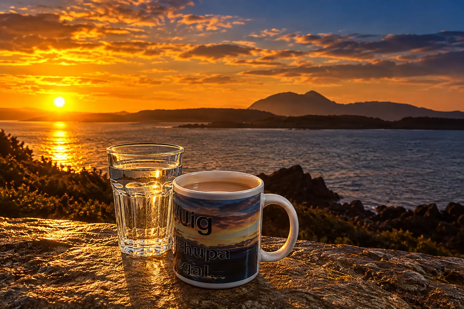
Watchers Lined Up From Shetland to Midlem
Ten named contributors made the morning gallery, from Sandwick on Shetland to Midlem in the Scottish Borders. The spread is the point. One clear night wrote the same orange line on water, roofs, trees and a Moray horizon, while the west already showed more cloud.
THE THURSDAY SUNRISE TRAIL
| Place | Watcher | What they caught |
|---|---|---|
| Musselburgh, East Lothian | Send in the clouds | Sun rising over the water |
| Midlem, Scottish Borders | Hadi | Rays on inland ground |
| Coatbridge, North Lanarkshire | earlybird coatbridge | Sun through trees on a walk |
| Arbroath, Angus | Fleur | Sunrise after a 2°C start |
| Woodside, Perth and Kinross | Lara | Light over nearby roofs |
| Clachan, Argyll and Bute | Fuaran | Sky colour on the water, some cloud |
| Findochty, Moray | JC Moray | Cloudier start, orange on the horizon |
| Sandwick, Shetland | Amyofcourse | Sun over the coast |
| Tain, Highlands | Iolaire | Sun far on the horizon |
| Crossbost, Western Isles | Scotch Missed | Sun into a clear sky |
Fuaran in Clachan and JC Moray in Findochty already had cloud in the frame. The east and the islands still had a hard horizon. That mix is what a dying clear slot looks like: the last clean light in one county, high cloud filling the next.
Joy Dunlop Told Listeners to Use the Window
Before the gallery went up, Dunlop was already on the early shift. At 05:18 UTC she posted a bilingual good morning from BBC Scotland Weather and put the forecast in one line.
Another chilly start this morning with plenty of early brightness, before it turns wet and windy.
Joy Dunlop, weather presenter, on X
A Shetland reply treated the sun as a short-lived gift. Dunlop’s answer was “make the most of it while you can!” She was not decorating the photos. She was timing them.
Madainn mhath dhuibh / Good morning, all, from the @BBCScotWeather early shift! Another chilly start this morning with plenty of early brightness, before it turns wet and windy. Hope you have a lovely day ☕️ pic.twitter.com/3Dv1tAWooK
— Joy Dunlop (@joydunlop) October 8, 2026
On air she said the clear skies had brought those beautiful pictures, then pointed to wind and rain. The Met Office Highlands and Eilean Siar forecast for Thursday 8 October put a number on that turn: a chilly start with sunny spells, then rain reaching the Isles around midday and sliding east across Highland, with strengthening southerly winds and a maximum of 12°C.
How Weather Watchers Get a Photo on Air
BBC Weather Watchers is a UK-only club for private people and amateur weather groups, open to anyone 16 or older to join. You pick a nickname and a home location, choose a weather symbol, and upload a photo of a place, not a person. Advanced users can add temperature, rain, pressure, wind and humidity. Presenters and producers then lift the shots that match the day’s weather story, crop them into the graphics system, and put them on air, online and on social feeds.
Liz Howell, then Head of BBC Weather, wrote in 2018 that more than 200,000 people signed up in the first three years and sent in 2.2 million reports. On an average day the weather centre alone could see 1,700 reports. Snow weeks swamp that. Nearly 60,000 people visited to post during heavy snow at the end of November 2017, and the pictures showed, in near real time, where flakes had started to fall.
Lead presenter Matt Taylor, marking ten years in September 2025, said the club launched to help the BBC tell the UK weather story more clearly, and that the only kit you need is the camera on your phone. Thursday’s Scottish set did that job in one pass: Shetland, the Western Isles, the Highlands, Moray, Angus, Perthshire, Lanarkshire, East Lothian and the Borders, filed before breakfast.
HOW A WATCHER FILES A REPORT
- Sign in: Use a BBC account, set a clean nickname, and choose the place you usually report from.
- Stamp the observation: Set the true date, time and town, not the time you sat down to upload.
- Pick a symbol: The post button stays dead until a weather symbol is selected.
- Shoot the place: Landscape frames of sky, water, frost or blown bins; no identifiable people in the foreground.
- Keep it spare: Cap yourself at 10 posts a day, and send one or two of your best frames, so the map is not one person on repeat.
An Editor’s Pick badge is the only public nod that a frame may run on television or in a gallery. Howell’s line still fits the Thursday haul: from Shetland to Jersey, the club has the UK covered.
Heat Escapes Faster Under a Clear Sky
After sunset the ground behaves like a cooling plate. It throws heat back into the air and, if nothing is in the way, out to space. The Met Office’s frost note is blunt about the next step: on clear nights heat escapes more efficiently, so the ground and the objects sitting on it lose warmth fast. Cloud does the opposite. Forecasters still say cloud acts like a blanket, trapping some of that outgoing heat and keeping surface temperatures closer to the air.
Grass, metal and a car windscreen cool quicker than tarmac, which is why a rural frost can sit on a field while a main road looks wet and dark. Light wind helps the chill pool. Mix the air and you drag slightly milder air down from above. Thursday’s Watcher set is that recipe in colour: long night, open sky over much of the east and the islands, and a 2°C reading on the Angus coast by the time Fleur lifted the camera.
Sunrise itself does not cancel the overnight loss at once. The lowest air temperature is often just before dawn, after the land has been shedding heat for hours. The orange in the Musselburgh water and the Crossbost sky is the sun arriving on a surface that had already paid out its warmth.
By Afternoon the West Was Already Wet
MWIS had the sequence in the British mountain summary issued on 7 October: early showers in north Scotland fading, a widely dry and bright slot for several midday hours, then high cloud building in the west, with wind and rain arriving in west Scotland during the afternoon and spreading east into the evening.
THE CLEAR SLOT CLOSES
- 8 October, dawn: Frosts in sheltered glens; bright sunshine through the morning; excellent visibility under the remaining clear sky.
- 8 October, midday: Rain reaches the Isles and extends slowly east across Highland, with strengthening southerly winds.
- 8 October, evening: Southwesterlies rebuild, to 45-50mph on Skye; hill-level air at 900m jumps toward 8 or 9°C as the milder flow arrives; feeling like -5°C in the wind later in the day.
- 9 October: Cloud and rain early, then bright spells and showers, heavier in the west, wintry above about 900-1000m, summit gales, a severe chill on high ground.
- 10 October: Another showery, windy day, 2°C at 900m, feeling like -10°C or colder in the direct wind.
- 11 October: A small ridge of high pressure builds from the west, winds ease, and the hills get a more settled, still cool day before mixed weather returns.
Friday’s live hill readings were already in that wetter air. On Ben More in Argyll and Bute the Met Office showed 6°C with heavy rain, a feels-like of 1°C, and gusts of 28mph from the west-southwest. The Highlands outlook for Friday put the daytime maximum at 13°C, with blustery showers heavier and more frequent in the west. MWIS had 3°C at 900m on Friday, feeling like -5 to -10°C in the wind, with hail in the shower stream and snow on the high tops.
The people who stood in the 07:30 light at Sandwick, Tain and Musselburgh were not shooting a settled autumn high. They were shooting the last clean hour of a slot the forecast had already priced in as finite.
Frequently Asked Questions
What is BBC Weather Watchers?
It is a UK-only reporting club, launched in November 2015, in which members file a weather symbol, a location and usually a photo so presenters can show conditions they cannot reach in person. Commercial firms cannot join; amateur weather groups can. There is no dedicated app, only a site built to work on a phone or tablet, and reports from outside the UK are not accepted.
How do you submit a Weather Watchers photo?
You cannot edit a report once it is up; you delete it and start again. Notes you type in the box stay private and never go on air. For television use, photos should be at least 1920 x 1080 pixels and no larger than 10 MB, and you must have taken the picture yourself. If a shot is used, an Editor’s Pick badge appears on the report, with no separate alert telling you which bulletin carried it.
Why do clear nights make mornings colder?
A ground frost can form even when the air, measured about a metre up, is still above 0°C, because grass, metal and tarmac shed heat faster than the air above them. That is why a windscreen can be white while a car thermometer reads a positive number. Patchy cloud is enough to slow that loss, which is why Thursday’s hardest colour sat under the clearest horizons.
When did BBC Weather Watchers start?
The club opened in November 2015. Matt Taylor’s tenth-anniversary note in September 2025 was an appeal for younger observers, including school classes posting through a teacher’s account, rather than a new product launch. Members still work under the original deal: you keep copyright in your own photos, and the BBC may use the reports in weather output.
Sunday’s brief ridge will give the hills a drier, brighter window, then the westerlies return. The next frames in the club feed will be showers, hail on the tops, and whatever light is left between them.

Edinburgh Opens a 2027 Tour Built for Time Trials

Korda Maps Auður From Meðalland to Irvine Bay

Apple Music Films Its New Logo in Mineral Oil

Oppo Prices the Pad Mini Above India’s iPad Mini

Austen Soaks Scotland Before Boelo Brings Weekend Gales

Volkswagen Sells the Osnabruck Plant to Clear a Board Fight

Apple’s Foldable iPhone Hinges on Samsung Display Supply

Saksham Gaur Finds He Is His Own Company’s Client

Tata Motors’ Iveco Tender Opens as Holders Still Decide

Onimusha Way of the Sword Preload Hits a Windows 11 Wall
-
 AUTO2 months ago
Volkswagen Sells the Osnabruck Plant to Clear a Board Fight
-
 NEWS2 months ago
Apple’s Foldable iPhone Hinges on Samsung Display Supply
-
 BUSINESS2 months ago
Saksham Gaur Finds He Is His Own Company’s Client
-
 AUTO2 months ago
Tata Motors’ Iveco Tender Opens as Holders Still Decide
-
 GAMING2 months ago
Onimusha Way of the Sword Preload Hits a Windows 11 Wall
-

 ENTERTAINMENT3 years ago
What is SD on Amazon Prime? – All You Need to Know
-

 BUSINESS2 months ago
Hyderabad 22-Carat Gold Jumps After a False Bargain
-

 NEWS2 months ago
iQOO 16 Locks 8,400 mAh While 100W Charging Holds