
NEWS
Early UK Snow Melts as Record Vortex Reversal Meets El Niño
The first yellow snow warning left 3cm at Spadeadam, then rain. A record-early polar vortex reversal and a very strong El Niño now pull winter opposite ways.

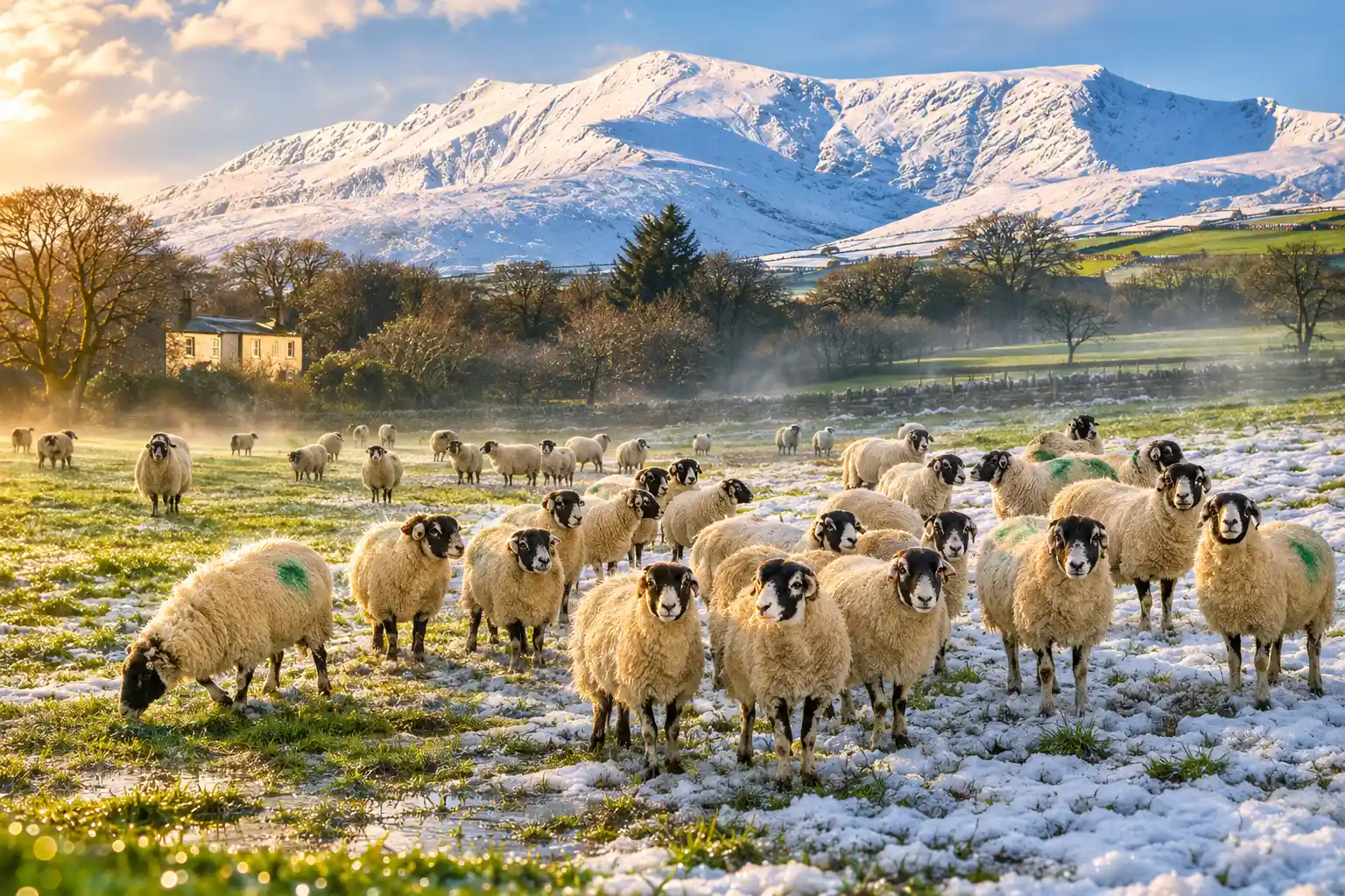
The Met Office’s first widespread yellow snow warning of the season left 3cm at Spadeadam in Cumbria on 17 November. Most of that cover has already melted.
Milder air and still-warm ground turned the rest to rain. The winter question is which of two giant climate signals, a record-early polar vortex reversal and a very strong El Niño, gets to shape December.
Three Centimetres at Spadeadam, Then Rain
The yellow warning ran until 11:00 GMT on Tuesday 17 November and stretched from Staffordshire to south-west Scotland. Met Office meteorologist Alex Burkill said a weather system feeding north-east would hit cold air already in place, with 5-15cm possible above 300-400 metres and a bit of lying snow at lower levels during the morning rush hour.
Chief Forecaster Dan Suri put settling snow above about 200 metres at 1-5cm in places, and 5-15cm above 300-400 metres. He said that away from higher ground, rain rather than snow would be the main story for many people. Major routes named in the warning included the A74(M), the A66 and the M62, with longer journey times on some railways as well.
Rain turned to snow over parts of the Pennines, the Cumbrian hills and Scotland’s Southern Uplands. Gusts of 40-50mph on high ground raised a separate risk that wet, heavy flakes would bring down branches and power lines. From a wet high street the warning looked oversized, because the 5-15cm band was always a hill forecast, not a city one.
THE SNOW WARNING AND WHAT FELL
| Band | Forecast | Logged |
|---|---|---|
| Ground above 300-400 metres | 5-15cm | Highest hills stayed wintry into the afternoon |
| Around 100 metres | 1-5cm, short-lived | Back to rain by mid-morning in many parts |
| Spadeadam, Cumbria | Inside the warning area | 3cm recorded by the Met Office |
| Most locations | Travel disruption on high ground | About 1-3cm, then a rapid thaw |
The Met Office confirmed the Spadeadam reading on Tuesday morning, while pictures from Tow Law in County Durham showed a brief white cover on fields and windscreens. By Wednesday 18 November that cover was largely gone.
It is a wet and windy start across the UK, with some hill snow too 🌧️
3cm of snow has been recorded at Spadeadam in Cumbria ❄️ pic.twitter.com/ybWcITz7bg
— Met Office (@metoffice) November 17, 2026
Frost Takes Over Once the Milder Air Arrives
Wednesday stays changeable. Further rain is due across northern England and Scotland, with a mix of brighter spells and showers elsewhere, some of them heavy enough for thunder in England and Wales. Any snow is limited to the highest mountains of Scotland, which is normal for mid-November.
Daytime values sit close to average, around 6 to 10C in the north and 9 to 13C in the south. Thursday and Friday look wetter again in southern England and Wales, and largely dry across Scotland and Northern Ireland. The colder story arrives after dark.
Overnight on Thursday and Friday it turns frosty for many. Widely, lows of minus 1 to minus 4C are likely across the Midlands, northern England and Scotland. Very locally, northern and eastern England and southern Scotland could see minus 8C on Friday night into Saturday, potentially the lowest reading of the autumn so far.
THE DAYS FROM THE VORTEX FLIP
- 10 November 2026: Stratospheric winds around the Arctic reverse from west to east, the threshold for a major sudden stratospheric warming.
- 11 November 2026: The easterly wind at 10 hPa, 60°N, reaches -2.4 metres per second, the deepest point of a three-day reversal.
- 15 November 2026, 9pm: A yellow cold-health alert begins for the North West, North East and Yorkshire and the Humber.
- 17 November 2026: The first widespread yellow snow warning of the season runs until 11:00 GMT; 3cm is recorded at Spadeadam.
- 18 November 2026: Rain takes over in the north, with showers further south and snow confined to the highest Scottish mountains.
- 19 November 2026, 9am: The current health alert is due to end, as nights turn widely frosty.
- 21 November 2026: Locally minus 8C is possible in northern and eastern England and southern Scotland.
That frost is a surface event in a still-warm November, not proof that a long freeze is locked in. The larger argument sits 30 kilometres up, and it started a week before the first yellow warning.
18 Days Earlier Than Any Vortex Reversal on Record
A sudden stratospheric warming is a rapid temperature jump high above the Arctic that can weaken, shift or split the polar vortex, the west-to-east wind that usually keeps the coldest air pooled over the pole. On 10 November those winds 30 km up reversed for three days, according to ERA5 analyses compiled at polarvortex.earth, with the most easterly reading of -2.4 metres per second on 11 November.
Lead weather presenters Sarah Keith-Lucas and Ben Rich said the switch marks the earliest major sudden stratospheric warming in modern observations. The previous earliest cases both fell on 28 November, in 1969 and again in 2025, so the 10 November flip arrived 18 days sooner. They also said the Tuesday snow was not a product of that reversal.
Any influence on the jet stream takes days to weeks to filter down. The 2018 Beast from the East followed a major warming a few weeks earlier, which is why a November reversal gets treated as a winter omen. This one is a poor copy of those mid-winter cases. There are almost no early-season examples to compare, the Arctic has not yet reached its late-winter cold, and the easterly phase lasted only three days.
The Met Office put meteorologist Alex Burkill in front of a deep dive on 17 November to walk through how the breakdown might still feed colder spells later, without treating Tuesday’s 3cm as the payoff.
If a surface fingerprint arrives at all, the usual lag puts it in late November and December, which is exactly when the other giant signal of this winter is supposed to be doing the opposite job.
El Niño Is Pulling British Winter the Other Way
Professor Adam Scaife, the Met Office’s head of long-range forecasting, has already called this Pacific event larger than anything in his forecast archive. Typical El Niño warming in the equatorial Pacific is 1-2C, and 2C is a big event. The office’s GloSea system has been showing El Niño forecasts of more than 3C in the Niño 3.4 region.
We should be clear that this is an unprecedented event. I have never seen an El Niño signal this intense in our forecasts.
Adam Scaife, Head of Long Range Forecasting, Met Office blog, 21 August 2026
Closer to the UK, the same briefing said El Niño raises the odds of wetter, stormier conditions across north-west Europe in autumn and early winter. NOAA’s Climate Prediction Center, in its 12 November diagnostic discussion, said El Niño continues to strengthen, with a strong-to-very strong event likely through January-March 2027, remaining greater than a 79% chance.
A Government Office for Science roundtable chaired by Met Office chief scientific adviser Stephen Belcher put the UK effects in two steps. From October to December 2026 there is a slightly increased chance of stormier weather, stronger westerlies and a higher flood risk. In early 2027 there is a slightly increased risk of easterlies, northerlies and cold snaps. The note also warned that a very large El Niño can scramble the usual North Atlantic pattern, so those are shifts in odds, not a promise of either floods or a freeze.
That is the bind. El Niño, on its own, wants a wet and windy open to winter. A major stratospheric warming, on its own, wants blocking, easterlies and a colder, drier spell a few weeks later. Both are now in play at once, and one of them happened on a date that has no clean analogue.
Who Faces the Yellow Cold-Health Alert?
The UK Health Security Agency has a yellow cold-health alert until 19 November for the North West, the North East and Yorkshire and the Humber, running from 9pm on Sunday 15 November to 9am on Thursday. Other English regions are unaffected. A yellow alert is aimed at people who feel a cold night first, not at a national shutdown.
Paul Coleman, a consultant in public health at UKHSA, said this is the latest cold-health alert of the season and more should be expected as winter deepens. Low temperatures can lift demand on health services and raise risk for older people and those with existing illness. The first alert of winter 2026/27 had already covered the North West and the West Midlands from 12 to 14 November.
WHO THE ALERT IS FOR
- Older adults: People aged 65 and over are named as a primary risk group when overnight temperatures fall.
- Existing illness: Respiratory and cardiovascular disease both raise the chance that a cold snap turns into a hospital visit.
- People sleeping rough: UKHSA lists them among the other groups with little buffer against a sharp overnight drop.
- Last winter’s toll: UKHSA’s cold mortality monitoring put 2,200 cold-associated deaths in England in winter 2025-26, down from 2,788 the winter before.
Paula Cowan, UKHSA’s regional director for primary care, communities and neighbourhood, urged people to take up winter vaccines when invited, keep warm, stay active, check on others and choose the right NHS service if they need help. The frost nights later this week are the part of the outlook that matches that alert. The melted 3cm is not.
December Is When the Two Signals Meet
Meteorological winter begins on 1 December. Long-range guidance has been pointing to a wetter, windier start than usual, which fits the El Niño early-winter pattern. El Niño also tends to raise the chance of polar-vortex trouble later in the season, which is the usual path toward colder, snowier weather in January and February.
This year that later-winter path has already been used, in autumn. The 10 November reversal is in the record books, the easterly phase has ended, and the surface response, if it comes, would arrive in the same weeks El Niño is trying to keep the Atlantic jet strong. Keith-Lucas and Rich said scientists are still unsure what that mix does, because the warming is so early and the Pacific event is so strong.
TWO SIGNALS FOR ONE WINTER
| Signal | Usual UK tilt | What is different now |
|---|---|---|
| Major sudden stratospheric warming | Colder, drier, more easterly flow a few weeks later | Earliest on record, only three days easterly, few analogues |
| Strong El Niño | Wetter, stormier, milder in autumn and early winter | Met Office forecasts more than 3C in Niño 3.4 |
| Late winter (early 2027) | Higher odds of easterlies and cold snaps after typical El Niño | A very large event can scramble that North Atlantic pattern |
| Next few days | Hill snow, then rain, then frost | Snow confined to Scottish summits; widely minus 1 to minus 4C by night |
On the highest Scottish mountains, snow is still in the Wednesday forecast, which is normal for mid-November. The 10 November reversal still has to work its way down, if it does, and El Niño is still climbing toward a December peak. The yellow warning itself expired at 11:00 GMT on 17 November.

Gold Prices Fall to a 14-Month Low Despite Strikes

SpiceJet Clears a Rs 5,500 Crore Raise After Mumbai Stalled

Honda Activa’s Record Month Came With a Share Loss

Sony Turns the GTA 6 Launch Into a Firmware Gate

Xiaomi 18 Leak Skips the Rear Screen for Battery

Volkswagen Sells the Osnabruck Plant to Clear a Board Fight

Apple’s Foldable iPhone Hinges on Samsung Display Supply

Saksham Gaur Finds He Is His Own Company’s Client

Tata Motors’ Iveco Tender Opens as Holders Still Decide

What Is SD on Amazon Prime?
-
 AUTO2 months ago
Volkswagen Sells the Osnabruck Plant to Clear a Board Fight
-
 NEWS3 months ago
Apple’s Foldable iPhone Hinges on Samsung Display Supply
-
 BUSINESS3 months ago
Saksham Gaur Finds He Is His Own Company’s Client
-
 AUTO3 months ago
Tata Motors’ Iveco Tender Opens as Holders Still Decide
-
 TECHNOLOGY3 years ago
What Is SD on Amazon Prime?
-

 BUSINESS3 months ago
Hyderabad 22-Carat Gold Jumps After a False Bargain
-

 GAMING3 months ago
Onimusha Way of the Sword Preload Hits a Windows 11 Wall
-

 BUSINESS3 months ago
UltraTech Ultravolt Launch Splits Friday Stocks to Watch