
NEWS
Police Scotland Puts Live Search Maps in Officers’ Hands
Police Scotland has replaced paper search maps with live GIS apps, so advisers can run a Highland missing-person search from another city.

Police Scotland has finished training almost 300 officers and staff to run missing-person and venue searches on live maps instead of paper. The force, which has 23,000 officers and staff and covers more than 28,000 square miles, used the kit at the Commonwealth Games in Glasgow in July 2026 and collected an Esri Special Achievement in GIS Award in San Diego.
The speed figure the force quotes, 50% to 75% faster, comes from search-and-seal work at COP26. The daily job is different: matching dogs, drones and mountain rescue to people who vanish across cities, glens and islands, sometimes from a desk that is not on that hill.
Almost 300 Users on One Live Search Map
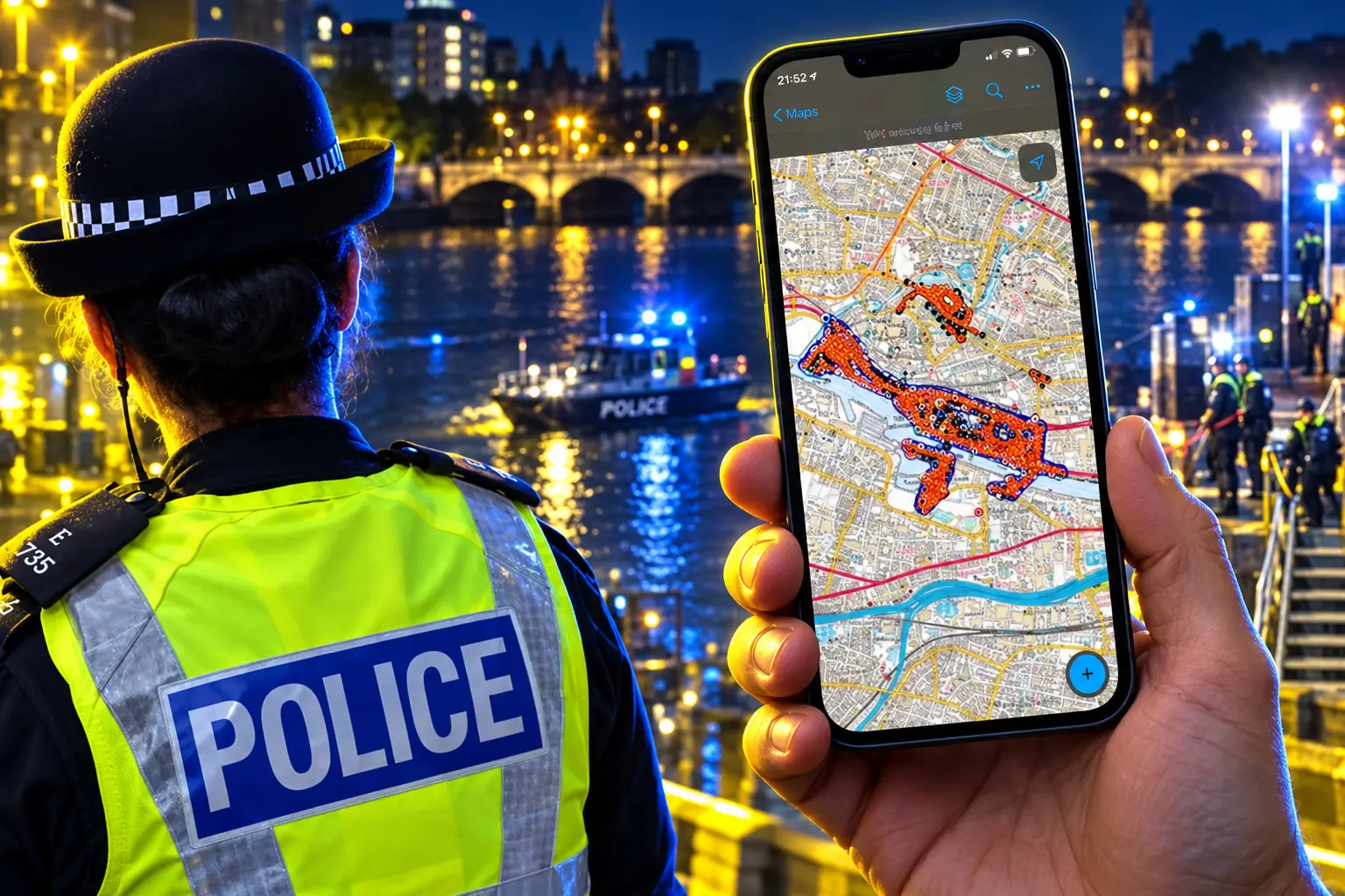
In September 2026 the force completed training for almost 300 users of the new geospatial apps, built with mapping firm Esri UK. Field officers get search boundaries on phones and tablets. Search advisers watch the same picture on interactive dashboards, including photographs of finds such as recovered clothing, so the plan can change while teams are still walking.
Inspector John Mackay, search coordinator at Police Scotland, tied the switch to decisions on the ground rather than to the award itself.
Search plays a critical role in keeping people safe from harm. By replacing complex paper-based processes with faster, streamlined digital workflows, we are helping officers make better decisions, deploy resources more effectively and deliver better outcomes for our communities.
Inspector John Mackay, Search Coordinator, Police Scotland
Every operational officer now carries a mobile device, and some carry tablets. They open a force intranet link, enter a missing person’s details, and get a ready-made web map. Quadrants can be colour-coded by risk. Updates that used to wait for a marked-up paper sheet at the end of a shift now leave the hill as soon as someone types.
Paper Maps Could Not Cover the Highlands and Islands
Scotland’s missing-person load is still large even after years of prevention work. The Scottish Government’s National Missing Persons Framework, published on 10 September 2025, records 14,670 missing person investigations from 1 April 2024 to 31 March 2025, about 40 a day, down from 16,259 and 45 a day in 2023-24.
THE CASELOAD THE MAPS NOW FACE
- Investigations: 14,670 in the year to 31 March 2025, about 40 a day.
- Children: 62% of investigations involve children, and 99% of missing people are found or return.
- Speed of close: 94% of those found or returned are back within 48 hours.
- Deaths: 97 people died after a missing report in 2024-25, down from 125 the year before.
Esri UK’s own case study still uses an older challenge figure of over 20,000 reports a year, two different quantities from the 14,670 investigations. That study cites the first UK costing of missing-person work at £2,415.80 a case and puts the bill at over £48 million a year if those 20,000 reports are the base. Chris Gardiner, head of public safety at Esri UK, put the UK total at over 170,000 missing people a year and about £700 million for policing.
The first 72 hours remain the window search advisers treat as vital. Paper maps, manual notes and hand-coloured sectors made that window slower, because someone had to carry the sheets back and type them up. Gordon Tyler, GIS lead at Police Scotland, put the old world in one line: “There was a lot of paper.”
Four Sheets of Paper for 7,000 Street Assets
The digital method did not start with missing people. It started with COP26 in Glasgow, held from 31 October to 13 November 2021, when 104 heads of state arrived and paper search-and-seal could not keep up. Officers had to inspect drains, vents, lamp posts and utility cabinets that could hide a weapon or a device, then fit tamper-evident seals and check them again through the summit.
Esri UK’s COP26 write-up says specialist teams used ArcGIS Field Maps to search and seal around 7,000 street assets, while senior officers watched ArcGIS Dashboards. The in-house GIS team built the workflow on devices officers already had. Coastguard staff got limited access on their own phones so they could flag broken seals without a second paper trail.
COP26 SEARCH AND SEAL, PAPER AGAINST LIVE MAPS
| Measure | Paper process | Live GIS workflow |
|---|---|---|
| Street assets | Could not scale with the staff on hand | Around 7,000 searched and sealed |
| Paper printed | Around five file boxes | Four sheets |
| Speed | Baseline | 50% to 75% faster |
| People on the job | About three times as many, the force estimates | 20 specialists, 20 coastguard, about 80 officers from English forces |
| Broken-seal delay | Could wait until the next day | Flagged at once on the dashboard |
Tyler said the old process “just could not be scaled to an event of this size.” Inspector Steve Hunter, a police search adviser and specialist role trainer, had pushed GIS since he used Esri tools at the G8 Summit in Scotland in 2005. After COP26 the same pattern moved into buildings: floor plans split into sectors, tasks handed out, progress watched if anything odd turned up.
Advisers in One City Run Searches on the Islands
The second change is the one paper could never offer. A specialist can now manage a search from another part of the country, which is how a national service covering cities, highlands and islands actually uses a live map. Partners on that picture include the Coast Guard, mountain rescue, fire and rescue, and search-and-rescue dog units.
UK police already had dense behavioural manuals that guess where a missing person is likely to walk. Tyler said those books “are very information heavy and they can take time to interpret, but our police search advisors really have to have that information at their fingertips.” The new workspace turns that guidance, and phone location data, into sectors a team can walk within minutes of a callout.
Time is absolutely critical when individuals are deemed to be at high risk. And as always, that location and geography component is absolutely key to our search planning and prioritization.
Gordon Tyler, GIS Lead, Police Scotland, Esri Safety and Security Summit 2026
As officers mark a sector in Field Maps, the manager sees the change in the dashboard, including how confident they felt about the sweep. Low-confidence ground can get a different team on the next shift. Tyler called the front end simple and the machinery behind it “PhD-level clever.” He also stressed the record: each inquiry lives in its own hosted service, because a missing-person file can become a murder case or a fatal accident inquiry.
How the Missing Persons Module Assigns Dogs, Drones and Divers
The Missing Persons Module is the everyday product of that COP26 method. Senior officers use it to plan a high-risk search and to hand ground to the unit that can actually cover it, while everyone watches the same updates, including a photograph of clothing found in a ditch. Steve Hunter said the module gives officers critical information in real time and that better information management helps them keep the public safe from harm.
UNITS THE LIVE MAP CAN TASK
- Dog teams: Ground that needs a scent search is drawn as a sector on the phone, not shaded in marker pen.
- Horses: Mounted units get the same boundary the foot teams see, so a sweep does not leave a strip unwalked.
- Drones: Air search is plotted against the same quadrants, and the force wants more of it.
- Diving and marine units: Water edges and harbours sit on the shared map with the hill sectors beside them.
- Fingertip search: Close, slow ground gets its own colour and a confidence mark when the team is done.
- Mountain rescue: Volunteer teams join the same picture instead of waiting for a paper brief at a roadside.
Mackay, on the Esri UK case page, called the result “a scalable, intuitive and cost-effective solution to a high-demand policing challenge.” Officers in outlying areas can cut their own sectors without posting a map back to a city office. The dashboard stores daily briefings and search history, so a night shift does not start from a stack of photocopies.
What Glasgow 2026 Borrowed From the COP26 Playbook
The same live picture went back to Glasgow for the Commonwealth Games in July 2026. Police Scotland said specialist search teams, with the mounted unit, dogs and armed policing, ran daily security checks at every venue before doors opened, in an 11-day operation that logged 7,500 officer and staff deployments. The force put 1,907 officers and 91 staff on the event, drawn from all 13 local policing divisions, and said more than 630,000 people came through venues, live sites and the Glasgow 2026 Festival.
For heads of state and royal visits, teams now add drone imagery and CAD drawings. The force has built virtual models of places it searches again and again, including the Palace of Holyroodhouse and the Royal Mile in Edinburgh, with known assets already on the file so a check starts faster. Digital floor plans split a building, hand out tasks, and show progress if something suspicious is found.
FROM G8 PAPER TO A SAN DIEGO AWARD
- 2005: Inspector Steve Hunter works the G8 Summit in Scotland and starts using Esri mapping tools.
- 31 October 2021: COP26 search-and-seal goes live on Field Maps and dashboards, covering around 7,000 street assets on four sheets of paper.
- 9 October 2025: Esri UK publishes the Missing Persons Module as the everyday version of that workflow.
- July 2026: The same method is used at the Commonwealth Games in Glasgow.
- 2026: Police Scotland is named on Esri’s list for a Special Achievement in GIS Award, chosen by Esri president Jack Dangermond.
- September 2026: Training for almost 300 users of the new apps is completed.
Winners of that award are listed for setting new standards in the global GIS community. Police Scotland appears on the 2026 roll as a United Kingdom law-enforcement winner of a Special Achievement in GIS Award.
Around 700 Long-Term Missing Files Stay Open
The maps are now in phones. The caseload is not a solved file. Around 700 people are classed as long-term missing, and up to 20 on average are not located within a year. Many of those people are believed to have died but have not been found, so the inquiries stay open. The 97 deaths after a missing report in 2024-25 are the lowest in the recent run the framework cites, and they are still 97 families.
Gardiner’s point was that GIS has moved off the analyst’s desk and into the field. That is true for almost 300 trained users. It does not, on the figures published so far, show that live maps have cut the 14,670 investigations, because those counts predate the September 2026 training finish and because the 50% to 75% speed gain was measured on COP26 seals, not on a child missing in the islands.
Police Scotland says it will put more drones in the air and keep building 3D views so officers get more context on the ground they are about to walk. Until those views exist, the live grid is still a 2D map that an adviser in one city can share with a dog team, a boat and a mountain rescue party on the same afternoon.
Frequently Asked Questions
When Did Police Scotland First Drop Paper for Search and Seal?
COP26 in Glasgow ran from 31 October to 13 November 2021 as a 25-day policing operation that secured 62 venues, including the Scottish Event Campus. The live maps were built for that summit’s drains, vents and lamp posts, then reused for buildings, royal visits and missing-person searches.
Do Officers Need GIS Skills to Use the New Search Apps?
Esri UK says officers using the Missing Persons Module do not need any specialist GIS experience. They upload a photo, a marker or a short note from a phone or tablet, instead of marking a paper map and handing it to a tasking officer at the end of the day.
Can Digital Search Logs Be Used as Evidence Later?
Tyler said the force keeps each inquiry in its own hosted service with managed access and a full digital audit trail, because a missing-person search can become a murder investigation, a fatal accident inquiry or a formal review of police decisions, and the log has to show what was searched, when and by whom.
What Mapping Products Sit Behind the New Search Tools?
The COP26 workflow used ArcGIS Field Maps, ArcGIS Dashboards and ArcGIS Online, and the Missing Persons Module is an automated template in ArcGIS Enterprise, put together by Police Scotland’s in-house GIS team on devices officers already carried.
How Many Missing Children in Scotland Are Care Experienced?
The 2025 framework says just under a third (33%) of child missing-person investigations relate to care experienced children, who are at higher risk of going missing more than once, while 31% of all recorded investigations carry a mental health flag.
The next test is not another summit. It is the next high-risk call on a wet island, with an adviser on a dashboard somewhere else, and a mountain rescue party walking a sector that used to live on a coloured sheet in someone’s bag.

Edinburgh Opens a 2027 Tour Built for Time Trials

Korda Maps Auður From Meðalland to Irvine Bay

Apple Music Films Its New Logo in Mineral Oil

Oppo Prices the Pad Mini Above India’s iPad Mini

Austen Soaks Scotland Before Boelo Brings Weekend Gales

Volkswagen Sells the Osnabruck Plant to Clear a Board Fight

Apple’s Foldable iPhone Hinges on Samsung Display Supply

Saksham Gaur Finds He Is His Own Company’s Client

Tata Motors’ Iveco Tender Opens as Holders Still Decide

Onimusha Way of the Sword Preload Hits a Windows 11 Wall
-
 AUTO2 months ago
Volkswagen Sells the Osnabruck Plant to Clear a Board Fight
-
 NEWS2 months ago
Apple’s Foldable iPhone Hinges on Samsung Display Supply
-
 AUTO2 months ago
Tata Motors’ Iveco Tender Opens as Holders Still Decide
-
 BUSINESS2 months ago
Saksham Gaur Finds He Is His Own Company’s Client
-
 GAMING2 months ago
Onimusha Way of the Sword Preload Hits a Windows 11 Wall
-

 ENTERTAINMENT3 years ago
What is SD on Amazon Prime? – All You Need to Know
-

 BUSINESS2 months ago
Hyderabad 22-Carat Gold Jumps After a False Bargain
-

 NEWS2 months ago
iQOO 16 Locks 8,400 mAh While 100W Charging Holds