
 Ishan Crawford
 A six-tonne sandstone block at the heart of Stonehenge could have ridden glacial ice from northeast Scotland as far as Dogger Bank, new ice-flow modeling shows, cutting the human journey that still had to follow.
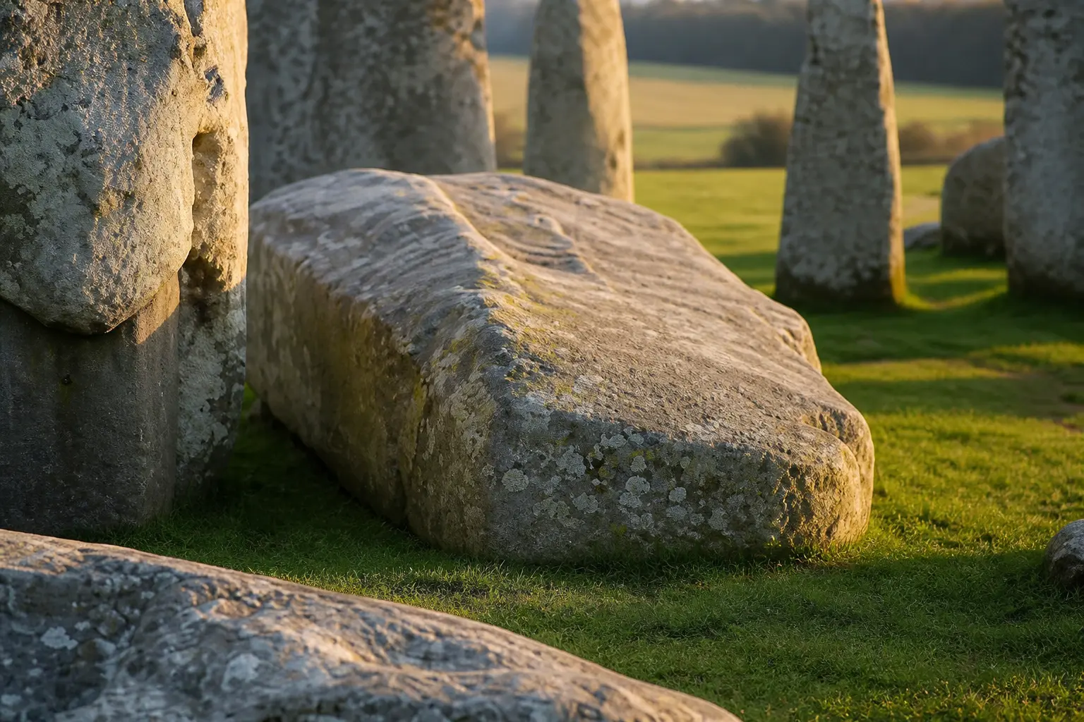
The Altar Stone sits toward the middle of the monument. It is the largest of the bluestones and the farthest-travelled of them all. Work published in the Journal of Quaternary Science tests whether Late Devensian ice could have moved rock from the Orcadian Basin southward. The answer is partial: yes to Dogger Bank, no farther into southern England.
That partial answer reshapes the problem without dissolving it. Ice may shorten one leg of the route. Every later leg still belongs to people who had to notice the stone, value it, and keep moving it as the coast changed under their feet.
The Scottish Sandstone at the Centre
In 2024 a multi-mineral study established a Scottish provenance for the Altar Stone. Detrital zircon, apatite and rutile ages match Old Red Sandstone of the Orcadian Basin, once the floor of ancient Lake Orcadie in northeast Scotland. That places the source roughly 700 km, and in one measure at least 750 km, from Salisbury Plain.
The stone measures about 4 to 4.9 metres long and weighs 6 tonnes. It is a pale green micaceous sandstone. Earlier ideas tied it to Welsh sources near the other bluestones. Those have been ruled out.
- 6 tonnes, heaviest of the travelled bluestones
- ~700 km, straight-line distance from Orcadian Basin outcrops
- Bluestone phase, earlier than the sarsen arches by about 2,000 years
- Placement window, likely added around 2620-2480 BCE
The bluestones arrived first. The larger sarsens came later from much closer sources. The Altar Stone’s Scottish match therefore sits outside the Welsh bluestone story and outside the local sarsen story at once. Its bulk and its distance make it the outlier inside an already long-distance monument.
Provenance alone does not dictate transport. It only fixes the starting geology. How the block left the Orcadian Basin and reached Wiltshire remains a separate question, one the new ice-flow work now narrows rather than closes.
Ice That Stopped Short of Salisbury
Glaciologist Remy Veness of Sheffield Hallam University and geochemist Anthony Clarke of Curtin University led the new modeling. Veness has spent five years building a numerical tool that predicts where glacial erratics can be dumped. Applied to the Orcadian Basin, the model shows multi-phase southeast ice flow during the last ice age could carry rock to Dogger Bank, a topographic high now under the North Sea.
Most ice from that sector of Scotland actually flowed northeast. A secondary southeast path is possible. Direct pathways all the way to southern England do not appear.
| Stage | Distance / outcome | Agent |
|---|---|---|
| Orcadian Basin to Dogger Bank | Plausible under model | Glacial ice |
| Dogger Bank to east coast England | ~ intermediate rescue needed | Human |
| East coast to Salisbury Plain | ~400 km remaining | Human |
| Direct Scotland to Stonehenge | No viable glacial path | – |
Clarke put the finding plainly: glaciers may have moved rocks part of the way, potentially as far as Dogger Bank, but not into southern England. Humans still had to cover hundreds of kilometres.
The model’s strength is its limit. It allows a southeast conveyor as far as the flooded high ground and then stops. That stop is the finding. Anything south of Dogger Bank falls outside the ice map and back into human logistics.
Why the Flooded High Ground Matters
Dogger Bank formed part of Doggerland, the now-drowned land bridge that once linked Britain to continental Europe. It sat as a local high point and collected glacial debris in a large moraine. Walking it after the ice retreated would have felt like a demolition yard mixed with a rock museum: erratics of many origins dumped at the end of the conveyor belt.
Neolithic people knew stone. They chose carefully for tools. An unusual six-tonne block could have stood out.
- ~15,000 years ago, ice still covering much of northern Britain begins its final retreat
- ~12,000 years ago, warming draws people north and west into the Doggerland plain
- 8-9,000 years ago (possibly as late as 7,000), rising seas finally drown Doggerland
- ~5,000 years ago onward, Stonehenge construction phases begin long after the island is gone
Because inundation happened well before the monument, any stone left on Dogger Bank had to be moved at least once while dry land still existed, then held at an intermediate site for millennia, then moved again to Salisbury Plain.
The bank therefore works as a halfway house only if people treated it as one. Ice can deliver. People must collect, store, and later re-commit to the load. The flooded high ground is both a possible dump site and a deadline.
Stages Forced by Rising Water
That multi-stage requirement is the awkward core of the glacier hypothesis. The paper itself notes that prolonged cultural significance or repeated activity across a large temporal gap would be needed. Clarke has described the full set of circumstances as increasingly elaborate.
Veness sees the same facts from the other direction. The findings could imply that people of Doggerland attached cultural value to the stone long before Stonehenge existed. They may have been willing to move it at least twice: first to keep it from the rising sea, later to its final place on the plain.
The Berkshire Ridgeway, often called Europe’s oldest road and active in the Neolithic, offered an east-west high route that leads toward Salisbury Plain. Once the stone reached the east coast of England, that corridor and possible river or coastal legs would have made the remaining haul comparable in scale to the other bluestones from Wales.
Water rise turns a single move into a chain. Rescue from the bank, holding on higher ground, and a final Neolithic transfer each demand labour and motive. The ice assists only the earliest of those steps.
What the Remaining Haul Still Demanded
Even under the most favourable glacial scenario the human task stays enormous. Overland hauling of a shaped 6-tonne block, combined with water transport where possible, across varied terrain, requires planning, labour organisation and landscape knowledge on a scale that still surprises researchers.
Rather than being carried naturally by ice, the evidence points to a deliberate, carefully planned movement across a challenging and varied landscape.
Clarke said that in a university statement accompanying the glacier before being transported to Salisbury release. Transporting a stone of this size over such a long distance would have required coordination and tremendous determination, he added.
The other bluestones travelled from the Preseli hills of Wales. The larger sarsens came from only about 25 km away, the locally sourced larger Sarsen Stones of the Marlborough Downs. The Altar Stone’s journey remains an order of magnitude longer.
| Stone group | Source region | Relative haul |
|---|---|---|
| Altar Stone | Orcadian Basin, then possible Dogger Bank stage | Longest; hundreds of km still human after any ice assist |
| Other bluestones | Preseli hills, Wales | Long-distance human move, shorter than full Scottish line |
| Sarsens | Marlborough Downs | About 25 km, local by comparison |
Scale alone does not prove method. It does show why a partial glacial leg still leaves a project that matches or exceeds the Welsh bluestone effort once the coast is reached.
Scotland’s Older Neolithic Threads
Northeast Scotland already holds clear Neolithic activity. Recent work on a pre-Stonehenge crannog mapped in Scotland and on Neolithic halls unearthed beneath a Scottish school shows complex building and water-edge life in the same broad northern zone that supplied the sandstone. Those sites sit older than the main Stonehenge phases. They do not prove a direct hand-off of the Altar Stone, yet they make long-distance contact and shared stone culture less surprising.
Public conversation on X has circled the same fork the paper leaves open. Some voices treat any glacial assist as a near-miracle of ice. Others note that every path still ends with humans moving six tonnes. A few, including writer Matt Ridley, have used the Doggerland speculation to argue for rebuilding a North Sea island. The sharper observation running through the replies is simpler: whatever agent first delivered the rock to the moraine, someone later decided it was worth saving when the sea came.
Northern building skill and southern monument phases need not be the same communities. They only need overlapping traditions of moving and marking stone across wide ground. The Scottish sites supply that background without naming the carriers of this particular block.
Ice Hands Off and People Take Over
The modeling draws a clean line between agents. Ice can explain arrival on Dogger Bank. It cannot explain presence on Salisbury Plain. The hand-off zone is the drowned moraine and the east coast that remained after the sea rose.
From that point the work looks like other Neolithic stone moves, only longer in cumulative distance and stretched across more generations if the holding stage lasted for millennia. Organisation, route knowledge, and a reason to keep the block all become necessary once the glacier is gone.
- Glacial leg: Orcadian Basin toward Dogger Bank under multi-phase southeast flow
- Rescue leg: off the bank to higher ground before final inundation
- Holding span: intermediate site or sites across a multi-millennial gap
- Final leg: east coast or inland corridor toward Salisbury Plain in the bluestone phase
Each leg has a different tempo. Ice moves on climate time. Rescue moves on sea-level time. The last haul moves on monument time. The stone has to survive all three clocks.
Why Keeping the Block Still Makes Sense
A six-tonne pale green sandstone slab is hard to ignore in a field of mixed erratics. Toolmakers already scanned landscapes for the right rock. A block that large and that distinct could shift from raw material to marker without much stretch of habit.
If communities on Doggerland marked it early, later groups inherited both the object and a story about it. Moving it ahead of the tide then looks less like a one-off stunt and more like care for an older claim on place. The paper’s own language of prolonged cultural significance fits that reading.
The Ridgeway and related corridors later give a practical path once the stone is already on the English side. Motive and route then meet. The remaining haul, still on the order of 400 km from a Dogger Bank start, becomes heavy but no longer mysterious in kind beside the Welsh bluestone traffic.
None of that is proven by the ice model. The model only keeps the first leg open and forces the later legs into human hands. Cultural continuity is the bridge the distances still require.
Frequently Asked Questions
What is the Altar Stone at Stonehenge?
It is the large recumbent sandstone megalith near the centre of the monument, Stone 80, measuring roughly 4-4.9 m long and weighing 6 tonnes. It is the heaviest of the bluestones and lies partly under fallen stones from a collapsed trilithon.
Where did the Altar Stone come from?
Geochemical and detrital mineral dating published in 2024 ties it to Old Red Sandstone of the Orcadian Basin in northeast Scotland, a former lake basin, rather than to Welsh or local English sources.
Could a glacier have carried the Altar Stone all the way to Stonehenge?
No. The 2026 ice-flow model finds no viable glacial pathway from the Orcadian Basin directly into southern England. The farthest realistic dump is Dogger Bank in the North Sea.
Why does Dogger Bank matter in the new theory?
It was a glacial moraine high point within Doggerland that could receive northern erratics. Because the bank flooded 8-9,000 years ago, any stone left there had to be moved by people to higher ground well before Stonehenge was built.
How far would humans still have had to move the stone?
From a Dogger Bank starting point the remaining distance to Salisbury Plain is on the order of 400 km, comparable to the other bluestones but still far longer than the sarsen haul.
The modeling does not close the case. It keeps glacial delivery to Dogger Bank on the table while underlining that the decisive stages were human, multi-generational and, if the cultural reading holds, a response to a landscape that was visibly disappearing under water.
Ice narrows the map. People still write the last chapters. The Altar Stone’s path, whether or not it ever rested on the lost bank, ends as a record of attention paid to one block across distances and centuries that no glacier could finish alone.
 ONGC licence frees Venezuela cash and operatorship talks
  Anthropic Hits $65 Billion Run Rate and Flips the AI Cash Test
  Supreme Court grounds the fare free-for-all with three-week clock
  Gold Nears $4400 as Soft Data Meets Oil Inflation Risk
  Nifty Slips as Zaggle Circuits and Dhoot Debuts Big
  Diesel Crack Tops $100 as Iran Rhetoric Lifts Crude