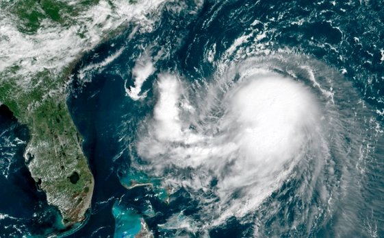
Scotland is bracing for a “weather bomb” as Storm Bert approaches, threatening to bring heavy snow, ice, and gale-force winds over the weekend. The storm, which is expected to cause significant disruption, has already prompted yellow and amber weather warnings for parts of the country. With temperatures plunging and the potential for travel chaos, Scots are being urged to stay informed and reconsider their weekend plans.
This powerful low-pressure system is set to make landfall by 3am, first hitting the east coast before sweeping across the mainland over the next several hours. While it will bring milder temperatures after pushing out the frigid Arctic air, the storm will first unleash a final deep freeze with extreme cold overnight, especially in rural areas. Some locations could experience temperatures as low as -14°C.
What Is a Weather Bomb?
In meteorological terms, a “weather bomb” refers to explosive cyclogenesis, a phenomenon where a storm’s pressure drops by 24 millibars within 24 hours. This rapid drop in pressure results in an intensifying storm, increasing its potential to cause extreme weather events. Storm Bert will undergo this process as it moves in from the Atlantic, intensifying into a formidable force capable of dumping significant snow.
This process will likely cause the storm to hit harder, bringing a mix of snow, heavy rain, and high winds that could bring much of Scotland to a standstill. While the storm’s intensity will vary across regions, the Highlands, Aberdeenshire, and other northern areas will face the most challenging conditions.

Snowfall and Freezing Temperatures
Scotland is no stranger to severe weather, but the amounts expected from Storm Bert are worrying. Forecasters predict more than a foot of snow in some areas, with several regions already seeing snow accumulation of several inches.
Here are some of the current snow depths reported:
- Loch Glascarnoch (Ross and Cromarty): 10 inches
- Altnaharra (Sutherland): 4 inches
- Lerwick (Shetland): 2 inches
But Storm Bert is expected to bring much more. As the storm intensifies, snowfall will continue to blanket the affected areas, making travel treacherous. The Highlands, in particular, will likely see some of the heaviest snowfalls, with rural roads becoming impassable and public transport facing delays. The risk of travel disruption is high, and experts are urging people to only travel if absolutely necessary.
Overnight temperatures in snow-covered areas could plummet to as low as -14°C, with rural spots already experiencing bone-chilling lows of -7°C and -6.5°C in places like Tulloch Bridge and Loch Glascarnoch. The storm’s arrival could bring the final blow to the extreme cold, pushing temperatures even lower before slightly milder weather sets in.
Gale-Force Winds and Flooding Threats
In addition to the snow, Storm Bert will bring gale-force winds that could lead to hazardous conditions across Scotland. Winds are expected to reach 70 mph or more in some areas, particularly on the east coast, where the storm will first make landfall. These strong winds could cause widespread disruption, knocking down trees, causing power outages, and making outdoor activities dangerous.
Heavy rain is also a major concern, as the storm moves across Scotland. With snow already on the ground, the combination of rainfall and melting snow could lead to localized flooding in certain areas. Regions at lower elevations will be most vulnerable, especially along the east coast, where rain is expected to be heaviest.
As always during severe weather events, it’s essential for residents and travelers to stay up-to-date on the latest warnings from the Met Office. Emergency services and local authorities are preparing for possible evacuations in vulnerable areas, and Scots are advised to stay home and avoid unnecessary travel.
Regional Impacts: What Areas Should Prepare?
Highlands and Aberdeenshire: Heavy Snow and Freezing Conditions
The Highlands and Aberdeenshire will bear the brunt of Storm Bert’s snow and ice. Expect over a foot of snow in some places, with winds making conditions even more hazardous. The storm’s impact could be especially severe in highland areas, where road closures and visibility problems are expected.
Perth and Kinross: Snow and Strong Winds
Perth and Kinross could experience significant snow and strong winds, which will likely disrupt daily life. Residents should prepare for possible power outages and transportation disruptions.
East Coast: Gale Force Winds and Rain
The east coast will be the first to feel the storm’s impact. Gale-force winds and heavy rain will cause dangerous driving conditions, especially for anyone traveling along coastal roads. Strong winds may also damage buildings, trees, and infrastructure.
Tips for Staying Safe During Storm Bert
With such severe conditions expected, it’s essential to stay informed and prepared. Here are some tips to stay safe:
- Travel with Caution: If you must travel, be prepared for delays, cancellations, and potential road closures. Keep an emergency kit in your vehicle and ensure your phone is fully charged.
- Stay Updated: Monitor the Met Office for the latest warnings and updates. Weather conditions can change rapidly, so it’s crucial to stay informed.
- Be Ready for Power Outages: Stock up on essential supplies, including food, water, and batteries. High winds could lead to power cuts, particularly in more remote areas.
Christopher Blanchett, BBC Scotland’s weather presenter, has stressed the importance of being ready for the storm’s full force and encouraged Scots to take the necessary precautions. With more snow, ice, and extreme winds on the way, Storm Bert is shaping up to be a major weather event for Scotland.


