Rail services in northern Scotland shut down key lines starting at 6 p.m. today as Storm Amy brings fierce winds up to 95 mph to the region. Operators like ScotRail made the call to protect passengers and staff from the storm’s dangers, which include flying debris and fallen trees.
Rail Closures: Full List of Affected Routes
ScotRail and Network Rail announced the closures to avoid risks during the peak of the storm. These lines will stop all services from 6 p.m. on Friday until further notice, mainly hitting remote highland areas.
The full list of closed routes includes popular lines that connect major towns and tourist spots. Travelers heading north should seek alternatives like buses or delays in plans.
- Inverness to Wick: This route serves the far north coast and will face total suspension.
- Inverness to Kyle of Lochalsh: Essential for access to the Isle of Skye, now offline.
- Inverness to Aberdeen: Links two key cities, disrupting daily commutes and freight.
- Inverness to Perth: Affects southern connections from the highlands.
- Mallaig to Fort William: Popular for scenic West Highland views, closed for safety.
- Fort William to Crianlarich: Another vital highland link, halted amid high winds.
Other parts of the network will run but at slower speeds. From 7 p.m., all trains limit to 50 mph to cut chances of accidents from gusts or obstacles on tracks.
Storm Amy Details and Weather Warnings
Storm Amy marks the first named storm of the 2025 season, forming a deep low pressure system that rushed toward the UK. It started building earlier this week and now targets Scotland with heavy rain and gales from Friday evening through Saturday morning.
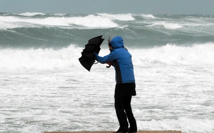
The Met Office raised an Amber warning for winds in northern and western Scotland, active from 5 p.m. Friday to 9 a.m. Saturday. Gusts could hit 60 to 70 mph inland and up to 95 mph on coasts, raising fears of power outages and structural damage.
Yellow warnings cover rain across much of Scotland from noon Friday, with 20 to 30 mm expected widely and up to 50 mm in hills. This adds flood risks, especially after recent wet weather that soaked the ground.
Experts note that such storms often lead to landslides in the highlands, based on past events like Storm Arwen in 2021 that knocked out power for days. Real time monitoring helps guide the response this time.
Safety Measures in Place for Rail Network
Network Rail focuses on safety first, pulling trains early to shield workers and riders from harm. Teams will inspect tracks once winds drop, using helicopters for quick scans of debris and floods.
ScotRail offers ticket flexibility to ease the blow. Passes for October 3 work on the 2nd, 4th, or 5th, giving options amid possible weekend delays for repairs.
Passengers get tips to check apps or sites before trips. Delays stem not just from wind but also rain that could wash out tracks or bring down trees, a common issue in rural spots.
This proactive step draws from lessons of prior storms, where last minute halts caused chaos. Now, clear plans help manage the chaos better.
Broader Travel Impacts and Advice
The storm hits more than just rails; roads face closures from fallen branches, and ferries to islands like Skye or Orkney may cancel sailings. Flights from airports in Inverness or Aberdeen could see holds too.
Drivers should watch for surface water and low visibility, with bridge limits in place. Transport Scotland urges checking routes ahead to avoid surprises.
For those stuck, local shelters open in affected towns, and emergency lines stay active. The storm’s timing on a Friday evening worsens weekend travel plans for many.
In related news, a similar gale last year in northern England closed lines for days, costing millions in fixes. This event underscores the need for stronger infrastructure against climate shifts.
| Warning Type | Areas Affected | Time Frame | Expected Impacts |
|---|---|---|---|
| Amber Wind | Northern and Western Scotland | 5 p.m. Fri to 9 a.m. Sat | Gusts up to 95 mph, power cuts, tree damage |
| Yellow Rain | Most of Scotland | Noon Fri to midnight | 20-50 mm rain, flooding, landslides |
| Yellow Wind | Northern Ireland, NW England | Fri evening to Sat | 60-80 mph gusts, travel delays |
Stay safe by planning ahead and following updates from official channels. Share your storm experiences in the comments below and spread this info to help others prepare.