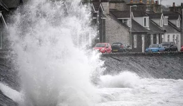
Scotland is bracing for a severe winter storm, as a “danger to life” weather warning has been issued. The Met Office forecasts an explosive cyclogenesis—commonly known as a weather bomb—set to hit the country this Friday, bringing strong winds, heavy rain, and possible snow.
Explosive Cyclogenesis: A Winter Weather Bomb
The Met Office has issued a yellow weather warning beginning at midnight on Friday, lasting until noon on Saturday. A rapidly deepening area of low pressure is expected to pass across the northwest of the UK during this period, with winds reaching 50-60 mph inland and as high as 70-80 mph along coastal regions.
This explosive cyclogenesis is expected to cause significant disruptions, including dangerous conditions on roads, railways, and air services. Coastal areas could see large waves and debris being thrown onto beaches, roads, and properties, leading to injuries and the potential for property damage.

Key Details of the Weather Bomb
- Winds: 50-60 mph inland, 70-80 mph along coastal regions.
- Impact: Flying debris, dangerous waves, and disruptions to transport services.
- Timing: Friday at midnight to Saturday at midday.
What is Explosive Cyclogenesis?
Explosive cyclogenesis refers to a rapidly deepening low-pressure system that intensifies by at least 24 millibars within 24 hours. This phenomenon is often linked to major winter storms, though it typically happens just a few times each winter. When such storms occur, they bring a potent combination of high winds, heavy rain, and snow, which can significantly affect daily life.
While this storm is not expected to be record-breaking in terms of pressure systems, the fast-developing low-pressure system will still bring disruptive weather, including frequent blustery showers and heavy rainfall. The Met Office has warned that the situation is still developing, and further updates may follow as confidence in the forecast increases.
The Impact on Scotland’s Weather
As the storm moves in, the western side of Scotland is expected to bear the brunt of the strong winds. Initial heavy rain will give way to blustery showers and possibly snow in the Highlands. This “pest from the west” storm will bring a spell of wet weather, with the heavy rain quickly followed by gusty winds and colder temperatures.
The storm’s track is still uncertain, but it is expected to bring a mix of weather hazards that could impact everyday life in Scotland. Authorities are urging residents to prepare for disruption and stay updated on weather warnings through the Met Office and local forecasts.
Preparing for the Storm
With the potential for disruptions to transport and severe weather conditions, residents and travelers are advised to take precautions:
- Stay informed: Keep an eye on weather warnings and updates from the Met Office.
- Travel safely: Expect delays and cancellations on roads, rail, and air travel.
- Secure property: Take measures to protect homes and businesses from high winds and debris.
This winter weather bomb is a reminder of Scotland’s vulnerability to extreme weather events, and the ongoing need for preparation and vigilance as the storm unfolds.


