Scotland is facing another spell of wintry weather as the Met Office has issued a yellow warning for ice across most of the country. The warning, which is in place from 6pm on Sunday to 10am on Monday, warns of possible travel disruption and injuries from slips and falls on icy surfaces.
Snow showers and freezing temperatures expected
According to the Met Office, snow showers are likely to affect parts of the Western Isles, Highlands, Grampian, Central, Tayside and Fife, Strathclyde and South West Scotland on Sunday evening and overnight. Some places may see 1-3 cm of snow, mainly above 100 m, with 5-10 cm possible over higher ground.
Temperatures are also expected to drop below freezing, with a low of -4°C forecast for Edinburgh and Glasgow, and -6°C for Aberdeen and Inverness. The cold snap follows a week of milder weather, which saw highs of 12°C in some areas.
Travel disruption and injuries possible
The Met Office has advised people to be aware of the potential impacts of the icy conditions, especially on untreated roads and pavements. It said: “Some roads and railways are likely to be affected with longer journey times by road, bus and train services. Some injuries from slips and falls on icy surfaces are possible.”
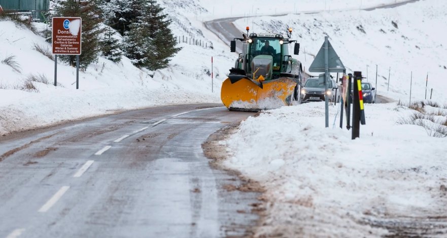
Traffic Scotland has urged drivers to plan ahead and check the latest travel information before setting off. It said: “Winter driving is a question of common sense and drivers should ask themselves if they really need to travel when conditions are poor. If you do, then plan your journey carefully, monitor weather reports and pack a snow kit of blankets, food, water and a shovel.”
More wintry weather to come
The yellow warning for ice is the first of three that the Met Office has issued for Scotland this week, as the country is set to experience more snow and cold temperatures. A second warning for snow and ice will come into force from 9pm on Monday to 11.59pm on Tuesday, covering the same areas as the first one, plus the Northern Isles.
A third warning for snow will start from 12am on Wednesday and last until 11.59pm on Thursday, affecting the Western Isles, Highlands, Grampian, Central, Tayside and Fife, Strathclyde and South West Scotland. The Met Office said: “Frequent snow showers may lead to travel disruption in places. There is a small chance of travel delays on roads with some stranded vehicles and passengers, along with delayed or cancelled rail and air travel. There is a slight chance that some rural communities could become cut off. There is a small chance that power cuts will occur and other services, such as mobile phone coverage, may be affected.”
STV meteorologist Sean Batty said: “Next week we go into cold northerly winds which will bring frequent heavy snow showers to the north and east, but with the risk of some longer spells of snow anywhere later in the week. One of the biggest shifts will be our temperatures with highs this week hitting double digits in the west, but by mid-week next week we could be looking at minus double digits in the Highlands, perhaps as low as -15°C in a few spots.”


