Northern Britain woke up to a proper battering today as Met Office yellow wind warnings cover Scotland, Northern Ireland, northern England, North Wales and the north Midlands. Gusts are already hitting 60-70 mph in places, with ferries cancelled, roads turning treacherous and the first proper taste of winter about to bite.
The wild weather is being driven by a fast-moving cold front that is barrelling south-east across the country this morning. Behind it, Arctic air is flooding in, temperatures are crashing, and snow is already starting to pile up on the Scottish mountains.
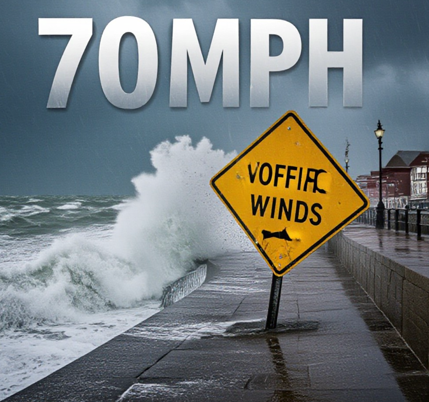
Winds Strong Enough to Halt Ferries and Topple Lorries
CalMac has already cancelled several sailings in the Western Isles, and more disruptions are expected through the morning in Scotland and Northern Ireland. The strongest gusts so far have been recorded on the Hebrides and the north-west Highlands.
Further south, the peak of the wind arrives this afternoon across northern England and North Wales. The Met Office says gusts of 60-70 mph are likely almost anywhere north of Manchester, with exposed routes on the M6, A66, A1 and A68 expected to be particularly nasty for high-sided vehicles.
Power cuts have already been reported in parts of Dumfries and Galloway and the Scottish Borders. Scottish and Southern Electricity Networks say engineers are on standby.
Arctic Air Brings Sharp Temperature Drop and Hill Snow
Once the front clears southwards late this afternoon and evening, the change will be dramatic. Temperatures will fall away sharply. Many places that reach 10-12°C this morning will struggle to hit 5-6°C on Friday.
The cold air is deep enough for snow to settle above 200-300 metres in Scotland tonight and through the weekend. The Cairngorms, Glencoe and Ben Nevis ski areas could see 10-20 cm of fresh cover by Saturday morning, with lower levels getting a dusting in wintry showers.
Further south, the hills of the Lake District, Pennines and North Wales will turn white above 400 metres by Friday night. Even parts of Dartmoor cannot be ruled out for a few flakes on Saturday.
Weekend Turns Properly Wintry
If you have plans this weekend, wrap up warm.
Friday and Saturday will feel raw nationwide. Daytime temperatures will struggle to reach 4-7°C in the north, 7-9°C in the south, and with brisk north or north-west winds it will feel close to freezing almost everywhere.
Wintry showers will continue to pepper northern and western coasts and hills. The best of any sunshine will be in the east and south-east, but even there it will feel bitter.
The cold spell is set to last well into next week. Some forecasters are now talking about the possibility of more widespread snow by mid-week if a new area of low pressure moves in from the Atlantic.
What You Need to Do Today
- Check CalMac, Irish Ferries and local train operators before travelling
- Secure garden furniture, wheelie bins and trampolines
- Drivers of vans and HGVs should take extra care on exposed routes
- Coastal paths and promenades will be dangerous with large waves and spray
- Keep an eye on vulnerable neighbours, especially the elderly
The Met Office warns that flying debris is possible and there is a small chance of injuries from large waves on beaches.
This is the first real blast of winter 2024 and it is arriving with a bang. After the mild autumn most of us have enjoyed, the sudden switch to Arctic conditions will come as a shock to the system.
Stay safe out there, keep the heating on, and maybe dig out the big coat you thought you would not need until January.
What do you think of this early taste of winter? Are you looking forward to the cold and snow, or dreading the heating bills? Drop your thoughts in the comments below and share your weather pictures with #UKWinterBlast.


